Anexo:Islas del archipiélago de las Hébridas Exteriores

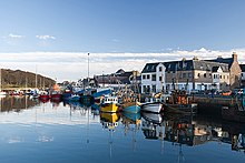
Este artículo recoge, en forma de tabla, una lista de las islas del archipiélago de las Hébridas Exteriores, uno de los archipiélagos más importantes de Escocia y del Reino Unido. Las Hébridas Exteriores son una cadena de más de 100 islas y pequeños arrecifes situados a unos 70 km al oeste de la Escocia continental. Hay 15 islas habitadas en el archipiélago, que también se conoce como las islas Occidentales (Western Isles) y arcaicamente como la Gran Isla (Long Isle; en gaélico escocés: An t-Eilean Fada[1]).
Lewis y Harris es la isla más grande de Escocia y la tercera más grande de las islas británicas, después de Gran Bretaña e Irlanda.[2] Incorpora la isla de Lewis en el norte y Harris en el sur, los cuales se refieren con frecuencia como islas individuales, a pesar de que están unidos por una frontera terrestre.[3] El asentamiento más grande en Lewis, y en las Hébridas Exteriores, es Stornoway.
Hacia el sur a través del sound de Harris se encuentran las Uists y Benbecula, que estaban unidas por una serie de calzadas construidas entre 1940 y 1960 para mejorar la red de transporte.[4] Más al sur están Barra y el grupo de las pequeñas islas Barra, cuyo extremo más meridional es Barra Head. Hay otros islotes exteriores con vínculos culturales con las Hébridas exteriores que no forman parte del propio archipiélago. Estos incluyen el grupo de St Kilda, que es muy diferente geológicamente y que ya no está habitado,[5] Sula Sgeir y North Rona, al norte, y el aislado de Rockall, que está a 367 km al oeste de North North Uist.[6]
Las islas de la costa oeste de Escocia se conocen colectivamente como islas Hébridas, estando las Hébridas exteriores separadas de las Hébridas Interiores por El Minch, al norte, y por el mar de las Hébridas, al sur. Las Hébridas Exteriores son administrados por Comhairle nan Eilean Siar y tenían una población en 2001 de 26.502 habitantes.[7] Las Hébridas exteriores han sido históricamente una zona en la que se habla mucho el gaélico escocés (Gàidhlig) . A pesar de los recientes descensos, en el censo de 2001, más del 50% de la población residente en cada isla era capaz de hablar gaélico, con un total de 15.842 hablantes en todo el archipiélago.[8] La economía moderna se centra en el turismo, el minifundio, la pesca y los tejidos, que incluye la fabricación de Harris tweed. El archipiélago está expuesto al viento y la marea, y hay numerosos faros como ayuda para la navegación.[9]
La definición de isla utilizada en esta lista es que se trata de «tierra que está rodeada de agua de mar diariamente, pero no necesariamente en todas las fases de la marea, excluyendo dispositivos humanos, tales como puentes y viaductos elevados».[10]
Islas habitadas
editar


Las islas habitadas de las Hébridas Exteriores tenían una población total de 26.502 en el Censo de 2001[7] y Lewis y Harris era la 13.ª isla más poblada de las islas británicas. Los picos más altos de las islas tienen nombres derivados tanto del gaélico como del nórdico antiguo, lo que indica la importancia histórica de estas dos culturas. El registro arqueológico de la época de la dominación vikinga durante la temprana Edad Media es sin embargo muy limitado, siendo las piezas de ajedrez de la isla de Lewis una excepción. Además de las calzadas North Ford (Oitir Mhòr) y South Ford que conectan North y South Uist, Benbecula y el norte de las dos Grimsays en la parte sur de la cadena de islas, algunas otras islas están conectadas por calzadas y puentes. Great Bernera y Scalpay tienen conexiones de puente con Lewis y Harris, respectivamente, y Baleshare y Berneray están conectadascona North Uist, Eriskay con South Uist, Flodaigh, Fraoch-eilean y el sur de Grimsay con Benbecula, y Vatersay está conectada con Barra por un viaducto elevado.[4][11][12] Esto significa que todas las islas habitadas están conectados al menos a una otra isla por una ruta de transporte terrestre.
Islas deshabitadas
editar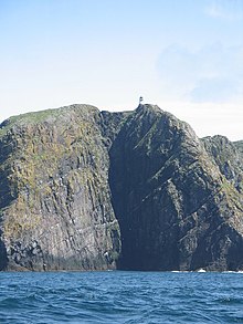
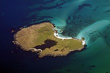
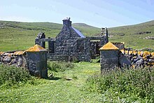
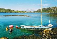
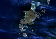
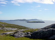
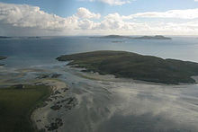
Esta es una lista de las islas con una superficie mayor de 25 hectáreas. Los registros de la última fecha con asentamientos permanentes de las islas menores no habitadas son incompletos, pero la mayoría de las islas que figuran en esta lista habrían sido habitadas en algún momento durante el Neolítico, la Edad del Hierro, Temprana Edad Media o períodos nórdicos. Al igual que en las otras cadenas de islas de Escocia, muchas de las islas más remotas fueron abandonadas durante los siglos XIX y XX, en algunos casos después de una residencia continuada desde el período prehistórico. Este proceso implicó una transición desde unos lugares que se percibían con unas economías agrícolas relativamente autosuficientes[13] hasta convertirse, tanto para residentes y extraños, en unas islas muy remotas que carecían de los servicios esenciales de una economía industrial moderna.[14]
Algunas de las islas siguen contribuyendo a la cultura moderna. La "Mingulay Boat Song", aunque evocadora de la vida en una isla, fue escrita después del abandono de la isla en 1938[15] y Taransay fue sede de la serie de la televisión de la BBC ‘’Castaway 2000’’. Otras han jugado un papel en la historia escocesa. El 4 de mayo de 1746, Bonnie Prince Charlie se escondió en Eilean Liubhaird con algunos de sus hombres durante cuatro días, mientras buques de la Royal Navy patrullaban el Minch. Acamparon bajo una vela estirada sobre una "choza baja lamentable" ("low pitiful hut"), mientras llovía torrencialmente.[16]
Las dificultades de definición son considerables en algunos casos. Por ejemplo, Haswell-Smith (2004) trata la isla de Eileanan Iasgaich[17] como una isla de 50 ha, a pesar de que durante las mareas altas se convierte en varios islotes mareales, ninguno de los cuales está siempre conectado a tierra firme de South Uist. A pesar de su nombre, Eilean an Taighe [casas isla], en las Islas Shiant, no reúne los requisitos para su inclusión en esta tabla, ya que está conectada con la isla de Garbh Eilean por un istmo natural.
Anexo:Islas de las Hébridas Exteriores
editarLa tabla se ha ordenado en orden geográfico, de norte a sur.
| Área | Población | Isla | Nombre en gaélico | Grupo[18] | Área (ha)[19] | Población[7] | Punto más elevado[20] | Altitud (m)[21] |
|---|---|---|---|---|---|---|---|---|
| 01 | 01 | Lewis y Harris | Leòdhas agus na Hearadh[22] | Lewis y Harris | 217 898 | 19 918 | Clisham | 799 |
| - | des. | Eilean Chaluim Chille | Eilean Chaluim Chille | Lewis (Loch Erisort) | 85 | 0[23] | Creag Mhor | 43 |
| 35 | des. | Eilean Liubhaird | Eilean Liubhaird | Lewis (Loch Sealg) | 125 | 0[24] | 76 | |
| 20 | des. | Isla Seaforth | Eilean Shìophoirt | Lewis (Loch Seaforth) | 273 | 0 | 217 | |
| - | des. | Sgeotasaigh | Sgeotasaigh | Harris (East Loch Tarbert) | 49 | 0[25] | 57 | |
| 15 | 06 | Scalpay | Sgalpaigh na Hearadh | Harris | 653 | 322 | Beinn Scorabhaig | 104 |
| - | des. | Eilean Mhuire | Eilean Mhuire | Islas Shiant | c. 25 | 0[26] | 90 | |
| 32 | des. | Garbh Eilean | Garbh Eilean | Islas Shiant | 143 | 0[27] | Mullach Buidhe | 160 |
| - | des. | Isla Stockinish | Eilean Stocainis | Harris | 49 | 0 | 44 | |
| 34 | des. | Little Bernera | Beàrnaraigh Beag | Lewis (Loch Ròg) | 138 | 0[28] | Tordal | 41 |
| 06 | 07 | Great Bernera | Beàrnaraigh Mòr | Lewis (Loch Ròg) | 2122 | 233 | 87 | |
| 38 | des. | Pabaigh Mòr | Pabaigh Mòr | Lewis (Loch Ròg) | 101 | 0[29] | Beinn Mhòr | 68 |
| - | des. | Vacsay | Bhacasaigh | Lewis (Loch Ròg) | 41 | 0[30] | 34 | |
| - | des. | Fuaigh Mòr | Fuaigh Mòr | Lewis (Loch Ròg) | 84 | 0[31] | Mullach na Beinne | 67 |
| - | des. | Fuaigh Beag | Fuaigh Beag | Lewis (Loch Ròg) | c.30 | 0[29] | 48 | |
| - | des. | Flodaigh | Flodaigh | Lewis (Loch Ròg) | c.30 | 0[29] | 48 | |
| - | des. | Ceabhaigh | Ceabhaigh | Lewis (Loch Ròg) | c.25 | 0 | 20 | |
| - | des. | Eilean Chearstaidh | Eilean Chearstaigh | Lewis (Loch Ròg) | 77 | 0[32] | 37 | |
| 36 | des. | Mealasta | Eilean Mhealasta | Lewis (Park) | 124 | 0[33] | Cnoc Àrd | 77 |
| 08 | des. | Scarp | An Sgarp | Harris | 1045 | 0[34] | Sròn Romul | 308 |
| 07 | des. | Taransay | Tarasaigh | Harris | 1475 | 0[35] | Ben Raah | 267 |
| - | des. | Soay Mor | Sòdhaigh Mòr | Harris | 45 | 0[36] | 37 | |
| 28 | des. | Ensay | Easaigh | Sound de Harris | 186 | 0[34] | 49 | |
| 29 | des. | Killegray | Ceileagraigh | Sound de Harris | 176 | 0[37] | 45 | |
| 13 | des. | Pabbay | Pabaigh | Sound de Harris | 820 | 0[38] | Beinn a' Chàrnain | 196 |
| 09 | 09 | Berneray | Beàrnaraigh | Uists y Benbecula | 1010 | 136 | Beinn Shleibhe | 93 |
| 03 | 03 | North Uist | Uibhist a Tuath | Uists y Benbecula | 30 305 | 1271 | Eaval | 347 |
| 27 | des. | Boreray | Boraraigh | North Uist | 198 | 0[39] | Mullach Mòr | 56 |
| - | des. | Stromay | Stròmaigh[40] | Sound de Harris | 66 | 0 | 16 | |
| - | des. | Tahay | Taghaigh | Sound de Harris | 53 | 0[41] | 65 | |
| - | des. | Hermetray | Theàrnatraigh | Sound de Harris | 72 | 0[42] | Compass Knoll | 35 |
| - | des. | Flodaigh Mòr | Flodaigh Mòr | North Uist | 58 | 0[32] | 28 | |
| 17 | des. | Ronay | Rònaigh | North Uist | 563 | 0[43] | Beinn á Charnain | 115 |
| 12 | 08 | Grimsay[44] | Griomasaigh | Uists y Benbecula | 833 | 201 | 22 | |
| - | des. | Fraoch-eilean | Fraoch-eilean | Uists y Benbecula | 55[45] | 0[46] | Cnoc Mor | 11 |
| 24 | des. | Kirkibost | Eilean Chirceboist | North Uist | 205 | 0 | 10 | |
| 26 | des. | Ceann Ear | An Ceann Ear | Islas Monach | 203 | 0[47] | 17 | |
| 30 | des. | Ceann Iar | An Ceann Iar | Islas Monach | 154 | 0[47] | Cnoc Bharr | 19 |
| - | des. | Sibhinis | Sibhinis | Islas Monach | 28 | 0 | 15 | |
| 04 | 04 | Benbecula | Beinn nam Fadhla | Uists y Benbecula | 8203 | 1219 | Ruaval | 124 |
| 19 | des. | Wiay | Fuidheigh | Benbecula | 375 | 0[27] | Beinn a' Tuath | 102 |
| 37 | 13 | Grimsay[44] | Griomasaigh | Uists y Benbecula | 117 | 19 | 20 | |
| 02 | 02 | South Uist | Uibhist a Deas | Uists y Benbecula | 32 026 | 1818 | Beinn Mhòr | 620 |
| - | des. | Stuley | Stulaigh | South Uist | 45 | 0[48] | 40 | |
| - | des. | Ceallasaigh Beag | Ceallasaigh Beag | North Uist (Loch Maddy) | 46 | 0 | 10 | |
| - | des. | Ceallasaigh Mòr | Ceallasaigh Mòr | North Uist (Loch Maddy) | 55[45] | 0 | 10 | |
| - | des. | Oronsay | Orasaigh | North Uist | 85 | 0[49] | 25 | |
| - | des. | Shillay | Siolaigh | North Uist | 47 | 0 | 79 | |
| 21 | des. | Vallay | Bhàlaigh | North Uist | 260 | 0[49] | Ceann Uachdarach | 38 |
| 11 | 12 | Baleshare | Am Baile Sear | Uists y Benbecula | 910 | 49 | 12 | |
| - | des. | Eileanan Iasgaich | Eileanan Iasgaich | South Uist | 50 | 0[32] | 20 | |
| 14 | 10 | Eriskay | Èirisgeigh | Uists y Benbecula | 703 | 133 | Ben Scrien | 185 |
| - | des. | Fiaraidh | Fiaraigh | Sound de Barra | 41 | 0 | 30 | |
| 23 | des. | Fuday | Fuideigh | Sound de Barra | 232 | 0[27] | Mullach Neacail | 89 |
| - | des. | Orosay | Orasaigh | Sound de Barra | c.30[12] | 0 | 38 | |
| 33 | des. | Hellisay | Theiliseigh | Sound de Barra | 142 | 0[50] | Beinn a' Chàrnain | 72 |
| - | des. | Flodday[51] | Flodaigh | Sound de Barra | 40 | 0[52] | 41 | |
| - | des. | Fuiay | Fuidheigh | Sound de Barra | 84 | 0[53] | 107 | |
| 05 | 05 | Barra | Barraigh | Barra | 5875 | 1078 | Heaval | 383 |
| - | des. | Gighay | Gioghaigh | Sound de Barra | 96 | 0[24] | Mullach a' Chàrnain | 95 |
| 10 | 11 | Vatersay | Bhatarsaigh | Barra | 960 | 94 | Theiseabhal Mòr | 190 |
| - | des. | Muldoanich | Maol Dòmhnaich | Islas Barra | 78 | 0 | Maol Dòmhnaich | 153 |
| 18 | des. | Sandray | Sanndraigh | Islas Barra | 385 | 0[54] | Carn Ghaltair | 207 |
| - | des. | Flodday[51] | Flodaigh | Islas Barra | 35 | 0 | 43 | |
| - | des. | Lingeigh | Lingeigh | Islas Barra | 27 | 0 | 83 | |
| 22 | des. | Pabbay | Pabaigh | Islas Barra | 250 | 0[55] | An Tobha | 171 |
| 16 | des. | Mingulay | Miùghalaigh | Islas Barra | 640 | 0[56] | Càrnan | 273 |
| 25 | des. | Barra Head o Berneray | Beàrnaraigh Cheann Bharraigh | Islas Barra | 204 | 0[57] | Sotan | 193 |
| 31 | 14 | Flodaigh | Flodaigh | Uists y Benbecula | 145 | 11[58] | 20 | |
| 03 | des. | Isla Boreray | San Kilda | San Kilda | 204 | 0[59] | Sotan | 193 |
Pequeños islotes y arrecifes
editar
Sigue una lista de pequeñas islas deshabitadas, islotes mareales —que solo quedan separados en las etapas más avanzadas de la marea— o arrecifes —que sólo quedan expuestos en marea baja— que rodean a las islas principales.[12] Muchos de ellos son oscuros y pocos han estado habitadas. Sin embargo, algunos tienen un alto grado de notabilidad. El islote sobre el que destaca el Castillo de Kisimul es la antigua sede del clan MacNeil y Shillay, en las islas Monach, tenía un faro habitado hasta 1942.[60] Los delgados Beasts of Holm de la costa este de Lewis fueron el lugar del hundimiento del Iolaire durante las primeras horas de 1919,[61] uno de los peores desastres marítimos en aguas del Reino Unido durante el siglo XX. Calvay, en el sound de la Barra, fue inspiración para Whiskey Galore, la novela de 1947 de Compton MacKenzie que narra cuando el SS Politician encalló allí con un cargamento de whisky. Inusualmente para una isla deshabitada, Eilean na Cille (NF847459) está conectada a Grimsay (sur) por una calzada.
Varios nombres gaélicos se utilizan repetidamente. Los sufijos ay o aigh o aidh, que proceden generalmente del nórdico øy, que significa «isla». Eilean (plural: eileanan) también significa «isla». Beag y mòr (también bheag y mhòr) significan «pequeño» y «grande» y se encuentran a menudo juntos. Sgeir es «escollo o arrecife» y a menudo se refiere a una roca o rocas que yacen sumergidos en la marea alta. Dubh es «negro», dearg «rojo» y glas significa «gris» o «verde». Orasaigh, derivado del nórdico Örfirirsey, significa «marea» o «isla reflujo».[62]
Pequeñas islas agrupadas geográficamente:
Barra y las islas Barra
editar- Barra: Eilean a' Mhail, Eilean Mhiathlais, Eileanan Dubha, Greanamul, Healam, Kisimul Castle, Lamalum, Lingeigh-Fada, Orasaigh (2), Sgeir Mhòr, Sgeirislum
- Barra Head: Rubha Niosaim and Sgeir Mhòr
- Flodday: None
- Lingeigh: None.
- Mingulay: Arnamuil, Barnacle Rock, Geirum Beag, Geirum Mòr, Gunamul. Lianamul, Sgeirean nan Uibhein, Solon Beag, Solon Mòr, Sròn à Dùin and The Red Boy.
- Muldoanich: An Laogh, Sgeirean Fiaclach.
- Pabbay: Greenamul, Heisgeir a-muigh, Heisgeir a-staigh, Lingeigh, Roisnis
- Sandray: Cleite, Creag an Sheadair, Eilean Mòr, Sgeir Lithinis
- Vatersay: Biruaslum, Orasaigh, Sgeir Liath, Sgeir na Muice, Snuasamul, Uineasan
Sound of Barra
editar- Eriskay: Calbhaigh, Eilean à Gheoidh, Eileanan Dubha, Hearteamul, Lingay, Na Stacan Dubha, Sgeir an Fheidh
- Fiaraidh: Corran Bàn
- Flodday: Snagaras
- Fuday: Traillisgeir
- Fuiay: Eilean Sheumis, Garbh Lingeigh
- Gighay: Eilean à Ceud
- Hellisay: Bodha nan Sgeiran Mòra
- Orosay: None
South Uist
editar- Costa Oeste: Eilean Bheirean, Eilean Cuithe nam Fiadh, Gualan, Orasaigh
- Costa Noreste: Dioraigh, Eilean à Mhadaidh, Eilean Ban, Eilean Ornais, Eilean na h-Airde Mhoire, Gasaigh, Glas-Eileanan, Luirsaigh Dubh, Luirsaigh Glas, Orasaigh, Sioloagh Mòr, Tathanais
- Costa Este: Calbhaigh (2), Dùn Othail, Eilean nan Ghamna
- Lochboisdale:
- Eileanan Iasgaich: Grupo principal: Eilean Bàgh Mhic Rois, Eileanan Iasgaich Beag, Eileanan Iasgaich Meadhonach, Eileanan Iasgaich Mòr, Eilean nam Feannag. Surrounding: Eilean Mòr, Eilean nan Moireachean, Gasaigh, Pabaigh, Sgeir Chaise
- Stuley: Dubh-Sgeir Mhòr, Glas-Eilean Mòr
Benbecula
editar- Costa Norte: Calabhagh, Eilean Leathann, Eilean Mhic Caoilte, Sunamul, Traillabreac Mòr
- Costa Este: Bearran, Collam, Eilean Baile Gearriadh, Eilean Dubh na Muice, Eilean nan Each, Fuidheigh Beag, Greanamul, Greanamul Deas, Maithidh Glas, Maithidh Riabhach, Maragaidh Beag, Maragaidh Mòr, Orasaigh (2), Orasaigh Uisgeabhagh
- Costa Sur: Eilean Ard an Eoin, Heistamuil
- Fraoch-eilean: Eilean Roinoch, Mas Grimsay
- Flodaigh: Lingay and numerous others but none named by Ordnance Survey
- Grimsay (North): Eilean à Ghobha, Eilean Mòr
- Grimsay (South): Caraigh Mhòr, Eilean nan Cille, Eilean nan Gamhna, Eileanan Stafa, Fodragaigh, Oitir Bheag, Siusaigh, Steiseigh, Triallabreac
- Ronay: Eilean an Fheidh, Eilean na Clioche, Eilean nan h-Iolaire, Eilean nan Gamhna, Eilean nan Gearr, Garbh Eilean Mòr, Huanariagh
- Wiay: An Dubh-sgeir à Deas, Cleit Mhòr, Eileanan Chearabhaigh, Lingeigh, Reagam, Scaracleit
North Uist
editar- Costa Noroeste: Eilean Mhorain, Haskeir, Hasgeir Eagach, Lingeigh
- Traigh Bhalaigh: Eilean Dubh Mòr, Stangram, Torogaigh
- Sound de Harris, Este:
- Loch Mhic Phail: Cafuam, Croabhagun, Eilean Fhionnlaidh, Frobost Island, Hestum, Mealla Bru, Rangas, Teilum
- Costa Oeste: Causamul, Eilean Trostain
- Costa Este:
- Loch Euphort: Eilean an Stiobuill, Eilean Mhic Shealtair, Eilean nam Mult, Orasaigh, Riobhaig Mhòr, Steisaigh, Treanaigh
- Loch nam Madadh: Cnap Ruigh Dubh, Eilean Bhalaig, Eilean Phail, Fathoire, Fearamas, Flodaigh, Glas Eilean Mòr, Hamarsaigh, Madadh Beag, Madadh Gruamach, Madadh Mòr, Oronsay
- Ceallasaigh Mòr: Orasay
- Ceallasaigh Beag: Callum More, Cliasagh Beag, Cliasagh Mor, Corr Eilean Keallasay, Eileanan Dhomhnuill, Eilean Bridich, Eilean Gheoidh, Eilean Mhidhinis, Eilean nan Lion, Fearamas, Lonachan, Rhiobhagan Mhidhinis
- Costa Sur: Craigionn, Eilean an Teampaill, Eilean Iochdrach, Eilean Mòr
- Causeway: Eileanan Glasa, Eilean Ghiorr, Eilean Leathann, Eilean na h-Airigh, Gairbh-eilean
- Baleshare: Bhorogaigh, Eilean Mòr, Eilean nan Carnan, Glas-eilean Beag, Horaigh
- Flodaigh Mòr: Duibh-eilean, Flodaigh Beag
- Kirkibost: Bior Eilean, Eilean Mòr, Sromaigh
- Oronsay: Fuskafaol, Greanam, Lingay
- Vallay: Dun Tomaidh, Sgeir Dubh Mòr
Islas Monach
editar- Ceann Ear: Heilleam, Stocaigh
- Ceann Iar: Deasgair, Raisgeir, Stromay
- Shillay: Eilean Siorruidh, Thusigeirean
- Sibhinis: None
Sound de Harris
editar- Harris - Rubha Reinis to Gob an Tobha: Bumersam Beag, Copaigh, Craigo, Dun Arn, Eilean Reinis, Eire, Gilsaigh, Gousman, Grodhaigh, Gumersam Mhòr, Langaigh, Liungaigh, Saghaigh Beag, Saghaigh Mòr, Sgarabhaigh, Sgeir Sine, Sromaigh
- Berneray: Bhaiteam, Greineam, Torogaigh
- Boreray: Bogha Mairi, Spuir
- Ensay: Creag Ruadh, Dubh Sgeir, Sleicham, Sromaigh, Suam
- Hermetray: Bhacasaigh, Dun Mhic Leathann, Eileana Dubha, Fuam, Greineam, Grodaigh, Hulmatraigh, Orasaigh, Righe nam Ban
- Killegray: Caolaigh, Eilean Chodam, Eilean na Ceardaich, Langa Sgeir, Sgeir Dhubh, Sgeir Mhurain
- Pabbay: Cuidhnis
- Shillay: Siolaigh Beag
- Stromay: Heastam Sròmaigh, Rusgaigh, Orasaigh
- Tahay: Bhotarsaigh, Cleite nan Luch, Creag nan Sealladh, Fuam na h-Ola, Narstaigh, Opasaigh, Sarstaigh, Sgeir à Chuain, Sursaigh, Trollaman
West Harris
editar- Gob an Tobha to Rubha Huisinis: Gaisgeir, Glas-sgeir, Gloraig Huisinis, Gloraig Tharasaigh, Iosaigh
- Rubha Huisinis to Ceann Loch Resort: Greine Sgeir,
- Scarp: Cearstaigh, Duisgeir, Fladaigh
- Soay Mòr: Soay Beag
- Taransay: None
East Harris
editar- Loch Seaforth: Eilean Mharaig, Glas Sgeir
- Àrd Caol to Rubha Crago: Eilean Reiningeadil
- Rubha Crago to Rubha Bocaig (including East Loch Tarbert): Cuidsgeir, Eilean à Gheoidh, Eileanan à Ghille-bheid, Eilean Aird Rainis, Eilean an Direcleit, Eilean Dubh, Eilean Mhic Fionnlaidh, Eilean na Gearrabreac, Eilean na Sgaite, Gloraig à Chaimbeulach, Gloraig Dubh, Gloraig Iosal, Sgeir an Leim Mhoir, Sgeir Glas, Sgeir Urgha
- Rubha Bocaig to Rubha Reinis: (see also Stockinish Island): Bhalaigh, Caiream, Corr-eilean, Eilean Chuidhtinis, Eilean Dubh, Eilean Dubh Chollaim, Eilean Fhionnsbhaigh, Eilean Lingreabhaigh, Eilean Mhanais, Glas Sgeir (2)
- Scalpay: Fuam an Tolla, Greineam, Raiream, Rosaigh, Stiolamair, Stiughaigh, Stiughaigh na Leum, Thamarasaigh
- Sgeotasaigh: Eilean Dubh, Eilean Rainich, Sgeir Ghlas
- Stockinish: Eilean Leasait, Eilean nan Eun
Islas Shiant
editar- Eilean Mhuire: Seann Chaisteal
- Garbh Eilean: Sgeir Mianais
- The Galtachan: Bodach, Damhag, Galta Beag, Galta Mòr, Stacan Laidir, Sgeir Mhic a' Ghobha
Lewis
editarCosta Suroeste
editarCeann Loch Resort to Aird Dhrolaige: Liongam, Staca Liath
- Aird Dhrolaige to Camas Uig: Eilean Molach, Greineam, Sgeir an Tamna, Sgeir Liath, Staca Leathann
- Camas Uig: Fraoch Eilean, Leac Holm, Sarah's Island, Sgeir a' Chàis, Sgeir Liath, Sgeir Sheilibhig, Tom, Tolm
- Camas Uig to Gallan Head: Gallan Beg, Sgeir Fiabhaig Tarras, Sgeir Gallan
- Eilean Mhealasta: Hairsgeir Beag, Hairsgeir Mòr
Loch Ròg
editar- Loch Ròg:
- Loch Ceann Hulabhig: Eilean Trosdam, Eilean Orasaigh, Eilean an Tighe, Eimisgeir
- Loch Charlabhaigh: Eilean Bhinndealaim
- Loch Ròg Beag: Eilean Dubh, Eileanan Glasa
- Loch Shiadair: Crovag
- Ceabhaigh: Greinam, Sgeir nan Cliabh
- Eilean Chearstaidh: Bratanais Mòr, Eilean Sgarastaigh
- Flodaigh: Gousam
- Fuaigh Beag: Aird Orasaigh, Cliatasaigh, Eilean nam Feannag, Floday, Geile Sgeir, Garbh Eilean, Glas Eilean, Linngeam
- Fuaigh Mòr: EileanTeinis, Eunaigh Beag, Eunaigh Mòr, Geile Sgeir, Sgeir Dubh Mhòr, Sgeir Liath
- Great Bernera: Eilean Beag, Eilean Bhacasaigh, Eilean Mòr, Eilean Riosaigh, Eughlam, Greineam, Liongam Valasay
- Little Bernera: Bearasaigh, Campaigh, Cealasaigh, Cruitear, Cul Campaigh, Eilean Fir Chrothair, Flodaigh, Hairsgeir, Mas Sgier, Seanna Chnoc, Sgeir à Mhurain, Sgeir Dhearg, Sgeir na h-Aon Chaorocah.
- Pabaigh Mòr: Bogha Dubh, Mas Sgeir, Pabeigh Beag, Siaram Mòr
- Vacsay: Sgeir Bocaig, Sgeir Fail, Sgeir na h-Aon Chaorach, Trathasam
North west coast
editar- Aird Laimisiadair to Butt of Lewis: Buistean, Cleite Gile, Cul Chraigeam, Craigeam, Dubh Sgeir, Eilean Arnol, Lith Sgeir, Mas Sgeir, Sgeir Dhail, Sgeir Dhearg Cul Chraigeam, Sgeir Lainganish, Sgeir Mhòr, Stac à Phris
Costa Este
editar- Butt of Lewis to Tolsta Head: Am Braga, Braighe Mhòr, Dùn Èistean, Dun Eoradail, Eilean Glas, Mas Sgeir
- Tolsta Head to Tiumpan Head: Heisgeir, Lada Sgeir, Langasgeir Mòr, Sgeir Leathann
- Tiumpan Head to Rubha Raerinis: Beasts of Holm, Buaile Mhòr, Eilean à Chaise, Eilean à Chrotaich, Eilean Beag Phabail, Eilean Mòr Phabail, Eilean na Greinne, Eilean Grioda, Eilean nan Uan, Eilean Thuilm, Mol Shildinis, Sgeir Mhòr Shildinis
- Rubha Raerinis to Rubha na Creige Moire (including Loch Erisort and Loch Liurbost): Bhatarsaidh, Dun Bharclin, Eilean à Bhlair, Eilean Cheois, Eilean Glas, Eilean Miabhiag, Eilean Mòr Lacasaidh, Eilean Mhic Thormaid, Eilean Orasaigh (2), Eilean Rosaidh, Eilean Thoraidh, Garbh Eilean, Glas Sgeir, Riosaigh, Seumas Cleite, Sgeiran Arbhair, Sgeir Tanais, Stac Tabhaidh, Tabhaigh Beah, Tabhaigh Mòr, Tannaraidh
- Rubha na Creige Moire to Gob Rubha Uisnis (including Loch Sealg): Bogha Ruadh
- Gob Rubha Uisnis to Rubha Brìodog: Eilean Beag à Bhaigh, Eilean Dubh à Bhaigh, Eilean Glas na h-Acarsaid Fhalaich, Eilean Mòr à Bhaigh, Eilean Thinngartsaigh, Sgeir Mhòr Bhalamuis
- Eilean Chaluim Chille: Eilean Calabraigh, Crois Eilean, Duine, Eilean a Bhlair, Riasiagh, Sgeir nan Muirsgian, Sgeir nan Each
- Eilean Liubhaird: Sgeir Fhraoich, Sgeir nan Caorach, Stac à Bhaigh
- Seaforth Island: None
Pequeños archipiélagos
editarHay varios archipiélagos pequeños dentro de las Hébridas Exteriores. Son los iguientes:
- Islas Barra (o islas Bishop), localizadas al sur de Barra;
- Islas Flannan, localizadas 32 km al oeste de Lewis;
- Islas Monach, localizadas 9 km al oeste de North Uist;
- Islas Shiant, localizadas 7 km al sureste de Harris.
El grupo de San Kilda (Patrimonio de la Humanidad por la UNESCO en 1986)está a 64 kilómetros al oeste-noroeste de North Uist, y está prohibida todo tipo de población permanente.
Véase también
editar- Hébridas Exteriores
- Hébridas Interiores
- Anexo:Islas del archipiélago de las Hébridas Interiores
- Anexo:Islas del archipiélago de las Orcadas
- Anexo:Islas del archipiélago de las Shetland
- Anexo:Islas de Escocia
- Anexo:Islas del mar del Norte
- Anexo:Islas de las islas británicas
- Islands of the Clyde (en la Wikipedia en inglés)
- slands of the Forth (en la Wikipedia en inglés)
- History of the Outer Hebrides (en la Wikipedia en inglés)
- Flora and fauna of the Outer Hebrides (en la Wikipedia en inglés)
- Religion in the Outer Hebrides (en la Wikipedia en inglés)
- List of places in the Western Isles (en la Wikipedia en inglés)
Notas
editar- ↑ Murray (1973) notes that "Western Isles" has tended to mean "Outer Hebrides" since the creation of the Na h-Eileanan an Iar or Western Isles parliamentary constituency in 1918. The phrase can also be used to refer to the Hebrides in general. Murray also notes that "Gneiss Islands"—a reference to the underlying geology – is another name used to refer to the Outer Hebrides but that its use is "confined to books". Murray (1973) p. 32.
- ↑ Haswell-Smith (2004) p. 262.
- ↑ The island does not have a common name in either English or Gaelic and is referred to as "Lewis and Harris", "Lewis with Harris", "Harris with Lewis" etc. Thompson (1968) p. 13.
- ↑ a b "Fleet Histories" Caledonian MacBrayne. Consultado el 3 de agosto de 2009.
- ↑ Haswell-Smith (2004) pp. 313–331 lists these islands in "Section 9: The Atlantic Outliers".
- ↑ Aird an Runair, North Uist approximately Mean High Water Springs ETRS89 57°36'10.42010"N 7°32'56.63226"W, grid reference NF 68686,70560. Distance to Rockall approximately 366.966 km (228.022 mi / 198.146 nmi). Admiralty Chart NE Atlantic (1) Reykjanes Ridge & Rockall Plateau. Chart C6566. (2009) Imray, Laurie, Norie & Wilson. St Ives.
- ↑ a b c General Register Office for Scotland (2003).
- ↑ Mac an Tàilleir, Iain 1901–2001 Gaelic in the Census, PowerPoint Presentation made available via Linguae Celticae. Consultado el 1 de junio de 2008.
- ↑ "Lighthouse Library" Northern Lighthouse Board. Consultado el 14 de julio de 2007.
- ↑ 'land that is surrounded by seawater on a daily basis, but not necessarily at all stages of the tide, excluding human devices such as bridges and causeways'. En el contexto escocés se utilizan otras definiciones. Por ejemplo, la Oficina del Registro General de Escocia (General Register Office for Scotland ) define una isla como «una masa de tierra rodeada de agua, separada de la tierra firme escocesa» ['a mass of land surrounded by water, separate from the Scottish mainland' ], pero a unque incluye islas unidas por puentes, etc .no queda clara en esta definición. Haswell-Smith (2004), en Scottish Islands utiliza «Una isla es una porción de tierra, o grupo de porciones de tierra, que está completamente rodeada de agua en la bajamar astronómica y para la que no existen medios permanentes de accesos secos». [ 'an Island is a piece of land or group of pieces of land which is entirely surrounded by water at Lowest Astronomical Tide and to which there is no permanent means of dry access'.] Esto es ampliamente aceptado pero es poco útil, ya que excluye conscientemente las islas puente.
- ↑ Haswell-Smith (2004) pp. 205–253.
- ↑ a b c "Get-a-map". Ordnance Survey. Consultado 1–15 agosto de 2009.
- ↑ See for example Hunter (2000) pp. 152–158.
- ↑ Ver por ejemplo Maclean (1977) Capítulo 10: "Arcady Despoiled" pp. 125–35.
- ↑ "Mingulay Boat Song" Cantaria. Consultado el 26 de diciembre de 2006.
- ↑ Haswell-Smith (2004) pp. 282–83.
- ↑ Eileanan Iasgaich is at NF785186
- ↑ Geográficamente, las islas habitadas pueden fácilmente ser separadas en, o alrededor de, Lewis y Harris, Benbecula, las Uists y Barra.
- ↑ Haswell-Smith (2004) p. 206, excepto los indicados con una nota separada.
- ↑ Haswell-Smith (2004) and Ordnance Survey maps. Si no hay indicación, señala que no hay nombre registrado para esa eminencia.
- ↑ Los mapas de la Ordnance Survey marcan la altura sobre el nivel del mar de un punto alto en la mayoría de islas, pero en algún caso, este puede no ser el punto más alto.
- ↑ Thompson (1968) p. 13.
- ↑ Estuvo habitada hasta después del siglo XVI.
- ↑ a b Estuvo habitada hasta principios del siglo XIX.
- ↑ 1921
- ↑ Estuvo habitada hasta el siglo XVIII.
- ↑ a b c Estuvo habitada hasta 1901.
- ↑ Estuvo habitada hasta 1861.
- ↑ a b c Estuvo habitada hasta 1827.
- ↑ Estuvo habitada hasta 1869.
- ↑ Estuvo habitada hasta la década de 1840. Se dice que las Clearances eran aquí de naturaleza particularmente brutal . Haswell-Smith (2004) p. 306.
- ↑ a b c No hay datos censales sobre cuando estuvo, si lo estuvo, habitada.
- ↑ Estuvo habitada hasta 1823.
- ↑ a b Estuvo habitada hasta 1971.
- ↑ Estuvo habitada hasta 1974.
- ↑ Estuvo habitada hasta la década de 1890.
- ↑ Estuvo habitada hasta la década de 1970.
- ↑ Estuvo habitada hasta la década de 1970. Pabbay tenía una población de alrededor de 100 personas en el siglo XIX, pero fue abandonada en 1846 y en 1868 sólo había un solo pastor que vivía allí. Haswell-Smith (2004) p. 268.
- ↑ Estuvo habitada hasta la década de 1960.
- ↑ The gaelic name is Stromaigh in the Gazetteer for Scotland and the English name "Stromay" is used both here and by the JNCC. The Ordnance Survey calls the island Sròmaigh but this is not used in other sources. It is connected to North Uist at all but the highest stages of the tide and a JNCC report describes it as "the low 'island' of Stromay". "Stromay (Stromaigh)" Gazetteer for Scotland. Consultado el 12 de agosto de 2009. "Loch Maddy – Sound of Harris Coastline" (PDF) Geological Conservation Review 28 Consultado el 12 de agosto de 2009.
- ↑ Estuvo habitada hasta la década de 1850.
- ↑ Estuvo habitada hasta la década de 1840.
- ↑ Estuvo habitada hasta la década de 1920.
- ↑ a b There are two inhabited islands called "Grimsay" or Griomasaigh that are joined to Benbecula by a road causeway, one to the north at NF855572 and one to the south east at NF831473 .
- ↑ a b "Rick Livingstone’s Tables of the Islands of Scotland" (pdf) Argyll Yacht Charters. Consultado el 12 de diciembre de 2011.
- ↑ This island is at NF86058 and the evidence of both Ordnance Survey maps and photographs (e.g. "Houses on Seana Bhaile" Geograph. Consultado el 10 de agosto de 2009) indicates a resident population. There is even a name, "Seana Bhaile" for the main settlement. However, neither the census nor the main reference work (Haswell-Smith 2004) refer to the island at all. Its population is presumably included in nearby Grimsay by the census.
- ↑ a b Estuvo habitada hasta un momento entre 1931–33.
- ↑ Estuvo habitada probablemente hasta el siglo XIX. Haswell-Smith (2004) writes "old lazybeds and a few scattered shieling ruins show that Stuley was probably yet another place where people who were considered of less importance than sheep fought to survive." Haswell-Smith (2004) p. 234.
- ↑ a b Estuvo habitada hasta el siglo XIX.
- ↑ Estuvo habitada hasta 1890.
- ↑ a b There are two "Flodday"s near Barra. One is in the Barra Isles at NL612924, the other in the Sound de Barra to the north at NF751022}.
- ↑ 1851
- ↑ Estuvo habitada hasta mitad del siglo XIX.
- ↑ Estuvo habitada hasta 1934.
- ↑ Estuvo habitada hasta 1911–20.
- ↑ Estuvo habitada hasta 1912.
- ↑ Estuvo habitada hasta 1980.
- ↑ The 2001 census refers to the island by its anglified name of Flodda.
- ↑ Es Patrimonio de la Humanidad por la UNESCO.
- ↑ «Monach Light». Northern Lighthouse Board. Consultado el 8 de diciembre de 2007.
- ↑ a b Thompson (1968) p. 76.
- ↑ Mac an Tàilleir (2003) varias páginas.
Referencias
editar- Esta obra contiene una traducción derivada de «List of Outer Hebrides» de Wikipedia en inglés, publicada por sus editores bajo la Licencia de documentación libre de GNU y la Licencia Creative Commons Atribución-CompartirIgual 4.0 Internacional.
- El artículo de la Wikipedia en inglés recoge las siguientes referencias generales:
- Armit, Ian (1998) Scotland's Hidden History. Tempus (in association with Historic Scotland). ISBN 0-7486-6067-4
- "Occasional Paper No 10: Statistics for Inhabited Islands" (28 November 2003) General Register Office for Scotland. Edinburgh. Retrieved 15 September 2007.
- Haswell-Smith, Hamish. (2004) The Scottish Islands. Edinburgh. Canongate. ISBN 1-84195-454-3
- Hunter, James (2000) Last of the Free: A History of the Highlands and Islands of Scotland. Edinburgh. Mainstream. ISBN 1-84018-376-4
- Mac an Tàilleir, Iain (2003) Placenames/Ainmean-àite le buidheachas (pdf). Pàrlamaid na h-Alba. Retrieved 6 October 2009.
- Maclean, Charles (1977) Island on the Edge of the World: the Story of St. Kilda. Edinburgh. Canongate. ISBN 0-903937-41-7
- Ordnance Survey (2009) "Get-a-map". Retrieved 1–15 August 2009.
- Murray, W.H. (1973) The Islands of Western Scotland. London. Eyre Methuen. ISBN 0-413-30380-2
- Thompson, Francis (1968) Harris and Lewis, Outer Hebrides. Newton Abbot. David & Charles. ISBN 0-7153-4260-6