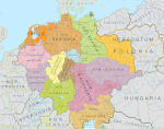
Archivo:Austria locator map (1000).svg

Tamaño de esta previsualización PNG del archivo SVG: 619 × 599 píxeles. Otras resoluciones: 248 × 240 píxeles · 496 × 480 píxeles · 793 × 768 píxeles · 1058 × 1024 píxeles · 2116 × 2048 píxeles · 1875 × 1815 píxeles.
Ver la imagen en su resolución original ((Imagen SVG, nominalmente 1875 × 1815 pixels, tamaño de archivo: 5,74 MB))
Historial del archivo
Haz clic sobre una fecha y hora para ver el archivo tal como apareció en ese momento.
| Fecha y hora | Miniatura | Dimensiones | Usuario | Comentario | |
|---|---|---|---|---|---|
| actual | 16:32 18 may 2016 |  | 1875 × 1815 (5,74 MB) | Alphathon | == {{int:filedesc}} == {{Inkscape}} {{Information |Description={{en|A map of the en:Margraviate of Austria (German: ''Markgrafschaft Österreich''; Old High German: ''Ostarrîchi'') within the Duchy of Bavaria around the year 1000. The map is... |
Usos del archivo
La siguiente página usa este archivo:
Uso global del archivo
Las wikis siguientes utilizan este archivo:
- Uso en arz.wiki.x.io
- Uso en ast.wiki.x.io
- Uso en cs.wiki.x.io
- Uso en en.wiki.x.io
- Uso en eo.wiki.x.io
- Uso en fi.wiki.x.io
- Uso en fr.wiki.x.io
- Uso en he.wiki.x.io
- Uso en hr.wiki.x.io
- Uso en hy.wiki.x.io
- Uso en id.wiki.x.io
- Uso en it.wiki.x.io
- Uso en ja.wiki.x.io
- Uso en ko.wiki.x.io
- Uso en pl.wiki.x.io
- Uso en pt.wiki.x.io
- Uso en ru.wiki.x.io
- Uso en sl.wiki.x.io
- Uso en uk.wiki.x.io
- Uso en vi.wiki.x.io
- Uso en www.wikidata.org
- Uso en zh.wiki.x.io


