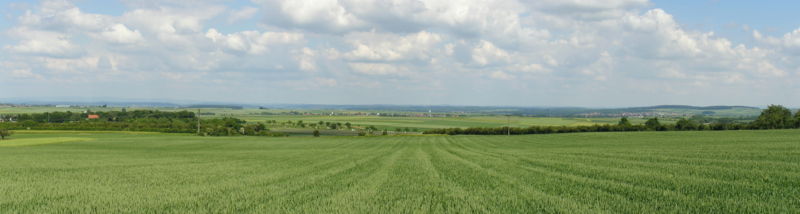
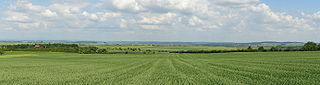
Deutsch: Die Wetterau, fotografiert vom westlichen Rand (fast am Taunus) zwischen Rosbach und dem Stadtteil Rodheim. Der Blick ist nach Osten gerichtet, das Tal im Vordergrund wird von der Nidda durchflossen.
English: The Wetterau, photographed from the western edge (near the Taunus) between Rosbach and the district Rodheim. The view is oriented to the east, the Nidda flows through the valley in the foreground.
Fecha
Tomada el 6 de junio de 2004
Fuente
Trabajo propio
Autor
MdE
Licencia
Update (11.02.2025): Open Street Map, Open Database License "ODbL" 1.0
A special license for you (including cost-free usage) may be available on request, also in some cases a higher resolution.
If you have any questions, feel free to contact me on my discussion page (unregistered writing possible, I will reply quickly) or send me an E-Mail (registered users only).
de compartir – de copiar, distribuir y transmitir el trabajo
de remezclar – de adaptar el trabajo
Bajo las siguientes condiciones:
atribución – Debes otorgar el crédito correspondiente, proporcionar un enlace a la licencia e indicar si realizaste algún cambio. Puedes hacerlo de cualquier manera razonable pero no de manera que sugiera que el licenciante te respalda a ti o al uso que hagas del trabajo.
compartir igual – En caso de mezclar, transformar o modificar este trabajo, deberás distribuir el trabajo resultante bajo la misma licencia o una compatible como el original.
{{User:MdE*C/FotoCC |InfoDE=Die Wetterau, fotografiert vom westlichen Rand (fast am Taunus) zwischen Rosbach und dem Stadtteil Rodheim. Der Blick ist nach Osten gerichtet, das Tal im Vordergrun

